
A tight little storm
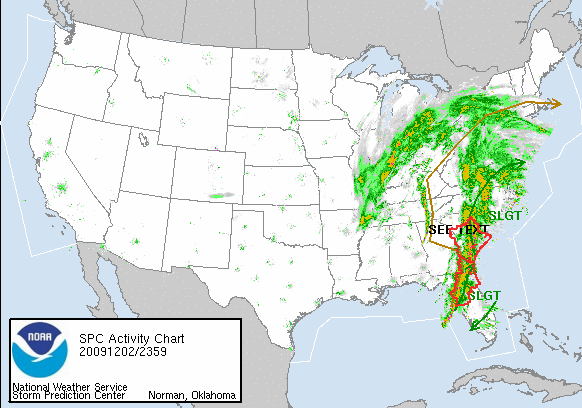
Tonight my wind chimes are tinkling and raindrops are splattering sideways onto my windows, all courtesy of a strong upper-level jet streak and associated low-level shortwave trough moving E and NE through the area. I've grabbed a couple of maps from around the web to capture the event, that includes near 70F dewpoints in the Carolinas (Greenville was mentioned in an SPC mesoscale discussion!), strong southeast warm-sector winds, and multiple bands of heavy rain/embedded thunder. There's even a PDS tornado watch valid for eastern NC/SC until 4 a.m. The earlier tor watches haven't verified (except for one report of a tornado this morning in the Fla panhandle); we'll have to wait and see what verifies overnight.


posted by Brad @ 8:54 PM
0 comments
![]()
0 Comments:
Post a Comment
<< Home